
Scroll
Featured
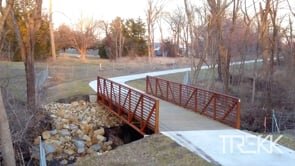
TREKK is IMPROVING LIVES through our design of pedestrian and bike trails. We are committed to developing transportation solutions that enhance safety, improve mobility, and promote accessibility for all users.
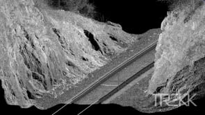
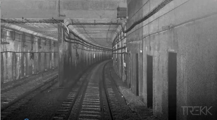
Rail surveying can be dangerous with costly down time. TREKK uses a combination of terrestrial mobile LiDAR, mounted on a hi-rail, and a wider aerial view capture of sUAS to obtain high-resolution data sets showing true topography.
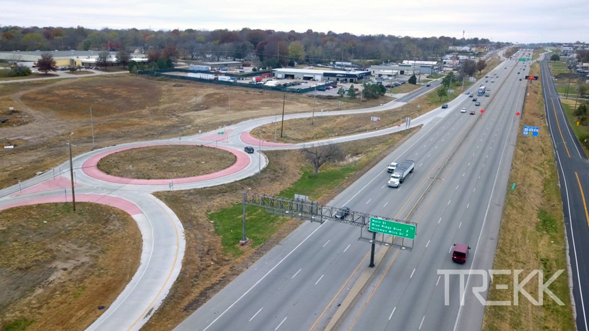
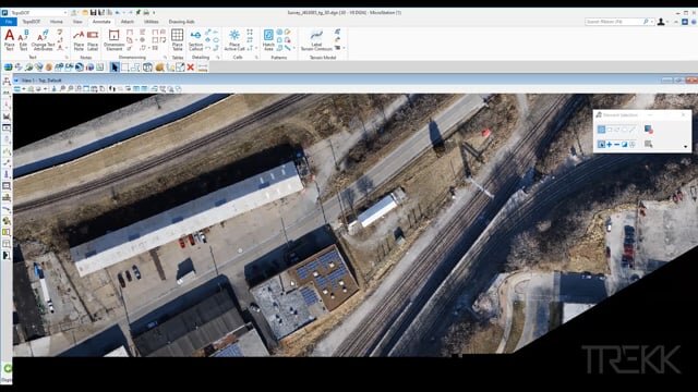
TREKK’s sUAS photogrammetry assists in providing analysis of existing traffic flow and conditions in roundabouts. From this aerial view the data can be used to make design modifications to improve continuous traffic flow and safety.
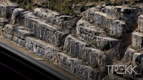
Geological hazards, such as rockslides, can be an unpredictable and unsafe environment. So, when MoDOT needed to survey a steep embankment along Route 65, TREKK provided a safe solution by deploying its sUAS drone system.
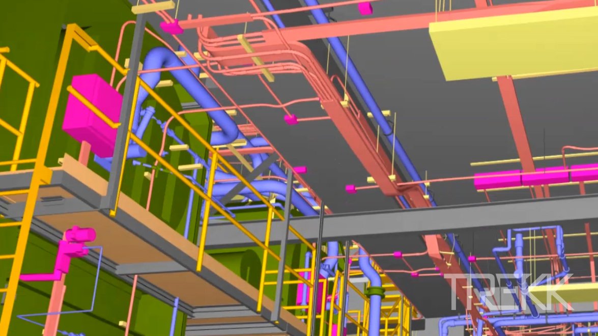
Facility management starts with detailed as-builts. TREKK uses static LiDAR to capture structural systems, MEP, and floorplans to create a digital twin to create a Building Information Model (BIM).
TREKK used UAV drone photography to create a rich, colorized 3D point cloud with a half-inch grid resolution to supplement our Terrestrial Model LiDAR acquisition.
TREKK provided traditional, mobile LiDAR, backpack/handheld LiDAR and aerial photogrammetry to survey Highway 169, I-35 and I-70 in preparation of the design-build bridge replacement.
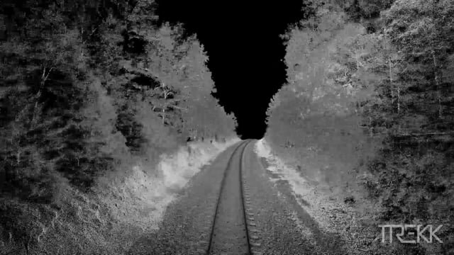
TREKK used mobile terrestrial LiDAR mounted on a hi-rail and aerial LiDAR on a UAV to obtain survey-grade topographic data along 4 miles of single track and a 250-feet corridor on each side of the track for the BNSF Railway in Hardy, Arkansas.
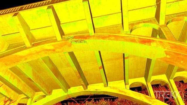
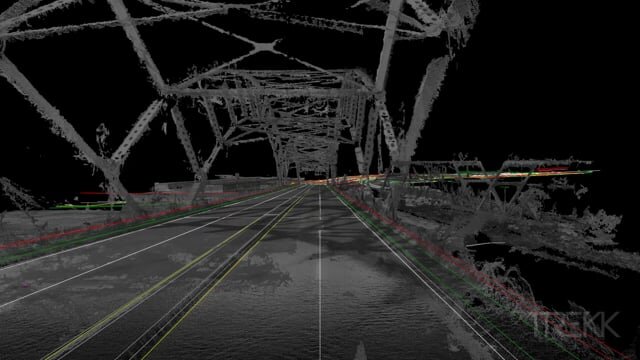
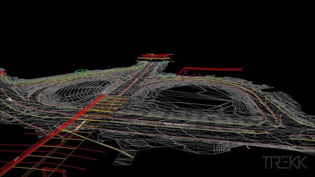
TREKK utilizes HD static scan systems to capture colorized, 3D point data of bridges and treatment plants and create survey-grade 3D models of specific areas of interest.
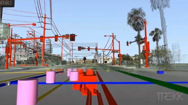
TREKK’s mobile LiDAR team documented 45 miles of downtown Las Vegas. The data was merged with subsurface utility data collected by Ground Penetrating Radar (GPR) for a complete Smart City model.
TREKK combined terrestrial mobile LiDAR, UAV drone LiDAR and UAV drone aerial photogrammetry to create a survey-grade topographic drawing of the Platteview Road corridor. The drawing was then utilized to design a 4-lane divided highway with interchanges.
TREKK collected mobile LiDAR and HD images along 3 miles of US 75 in Sioux City, Iowa. The images were used to create the final Digital Terrain Model and topo features deliverable.
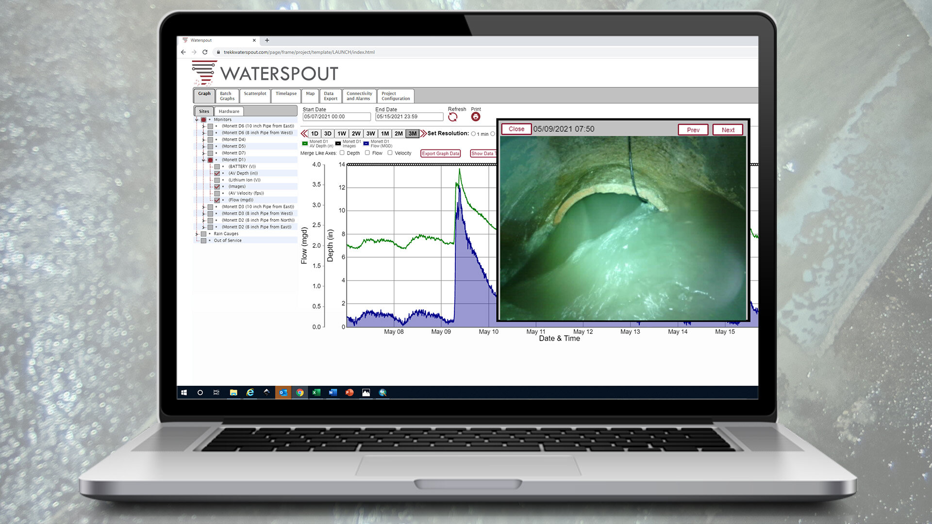
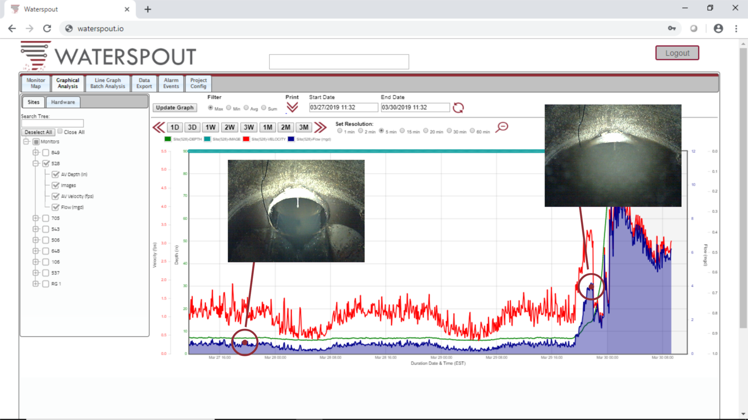
TREKK's Waterspout monitoring system allows users to remotely monitor and analyze data collected from sanitary sewer, water and stormwater systems. Powered by an artificial intelligence dashboard, Waterspout integration offers access to data, analytics and report functions for connected water infrastructure sensors, like our PreView cameras.
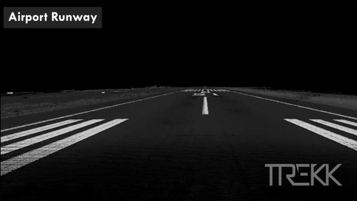
Time is an issue when collecting survey grade data on runways. By utilizing TREKK's terrestrial LiDAR system, we were able to collect the entire runway in 10 minutes for this FFA flight clearance project. Tarmacs and airport terminals can also be completely captured in a measurable, survey-grade 3D environment.
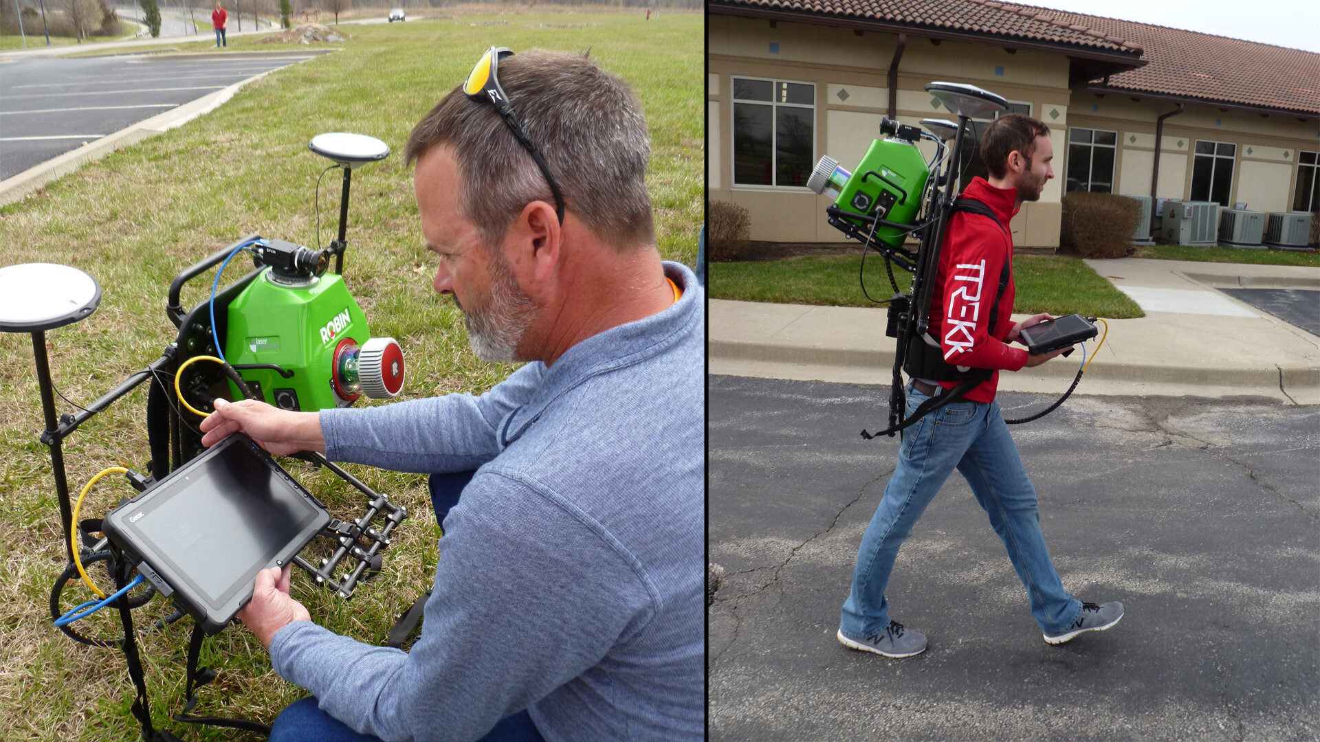
TREKK’s mobile LiDAR system can be mounted on a backpack to acquire images georeferenced to the point cloud. These images can then be used to create topo/digital terrain model of areas with limited access or restricted to vehicles.
TREKK collected mobile LiDAR and HD images along 3 miles of US 75 in Sioux City, Iowa resulting in the final digital terrain model (DTM) and topo features deliverable for a watermain.
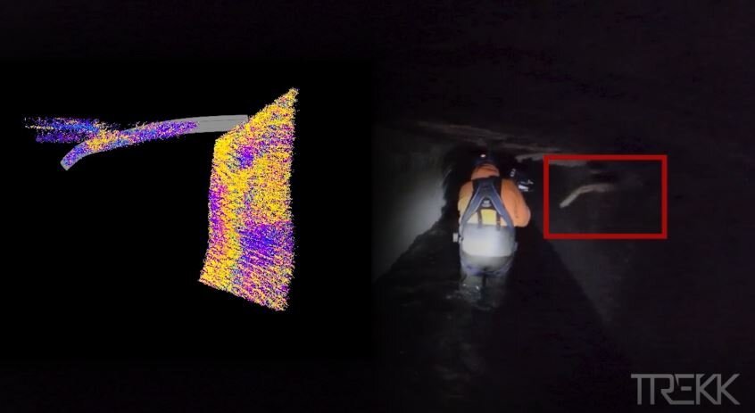
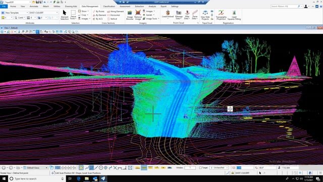
GPS isn’t an issue for TREKK’s portable HORIZON SLAM (Simultaneous Localization and Mapping System) to get accurate data in tunnels and underground vaults. Identifying features, like hanging rebar, can easily be isolated for condition assessment.
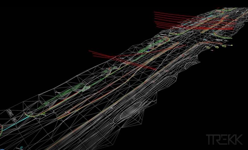
TREKK’s survey team used mobile LiDAR mounted on a hi-rail in conjunction with traditional streetscape legacy information to produce a representative layered program of system routes, both above and underground. The LiDAR data included identification of major disconnects between section areas for future repair.